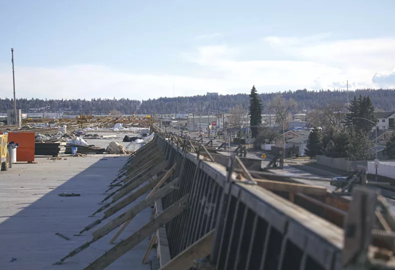
North Spokane Corridor proceeds southward toward I-90
Projects will be bid this year for work between Sprague, Mission avenues

A new segment of the North Spokane Corridor is now open to the public. The 1.5-mile stretch of freeway spans from Freya Street to the Wellesley Avenue interchange.
| Erica BullockA new segment of the $1.67 billion North Spokane Corridor is now open to the public, a 1.5-mile stretch of highway spanning from Freya Street to the Wellesley Avenue interchange, says Washington state Department of Transportation project engineer Terrence Lynch.
The advance marks seven completed miles out of the proposed 10.5-mile highway that eventually will link Interstate 90 on the south end to U.S. 2 and U.S. 395 highways north of Spokane.
Currently, the Spokane River Crossing project—a bridge that will connect an elevated portion near Spokane Community College to the north side of the river—is well underway, Lynch says. Several piers are in various stages of construction in addition to recently started work on retaining walls, he says. That section is on track to be completed by late 2025.
As for upcoming work, the DOT intends to hire contractors for two projects this year. In June, it will seek bids for Sprague Avenue-to-Spokane River stage three project, in which construction crews will build the elevated northbound and southbound bridges between Sprague and Alki avenues, says Lynch.
In November, DOT will advertise the contract for the Sprague Avenue-to-Spokane River stage two project. That segment consists of building a partial interchange at state Route 290, also known as Trent Avenue, and elevated northbound and southbound bridges between Alki and Mission avenues, Lynch says.
Costs for the projects are still under development, Lynch says. Early cost estimates for the Sprague Avenue-to-Spokane River stage three project are projected to be between $85 million and $95 million. Early estimates for the Sprague-to-Spokane River stage 2 project are between $175 million and $200 million, Lynch says.
Design work is underway for multiple projects that will connect the North Spokane Corridor to the I-90, Lynch says. Precise timelines for that work hasn't been set yet.
Also among the work completed last year is a 1.8-mile section of the Children of the Sun trail, a pedestrian and bicycle pathway that runs alongside the highway and will connect to the Centennial Trail. The completed section runs between Marietta Avenue and the trailhead at East Columbia Avenue in north Hillyard and opened to the public in December.
Features on the trail, including benches, kiosks, permanent signing, bridge lighting, and plazas are scheduled to be completed this spring.
“With this section included, the total length of the trail open for public use is now approximately 8 1/2 miles,” Lynch says. “Because the trail meanders and doesn’t follow a straight line like the highway, in the end, the trail is going to be about 12 miles in total length—longer than the freeway.”


_web.webp?t=1769673727)
_web.webp?t=1769673728)
_web.webp?t=1769673735)
